Maps and globes, which represent culturally important testimonies to the knowledge of the epoch in which they were created, form a very special category in the representation of the world. Here, we have compiled twelve historically significant examples for you that revolutionised the understanding of Earth.
Atlas Farnese
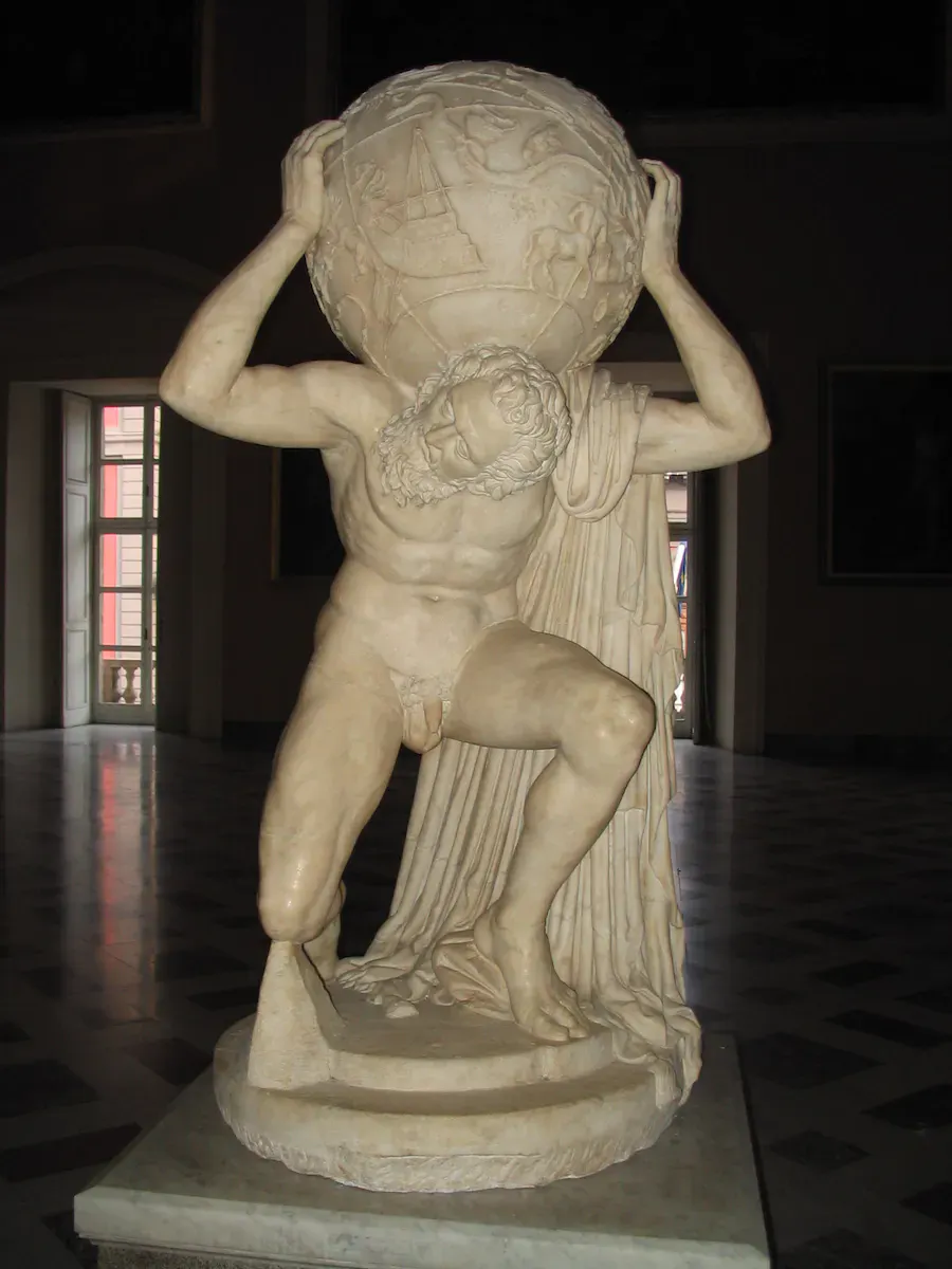
Globes already existed in ancient times when the earth was known to be spherical and not flat, so scholars such as Aristotle (384-322 BC) were concerned with calculating its circumference. Likewise, celestial globes are said to have existed that represented the constellations that were so important to the Greeks and Romans. None of these globes, however, have survived for thousands of years – at least not directly. In the National Archaeological Museum in Naples, there is a Roman marble copy of a Greek-Hellenistic sculpture depicting the Titan Atlas, who was punished after a rebellion against the gods of Olympus by having to carry the heavens. The Farnese Atlas shows him carrying the shape of a celestial globe. While the sculpture can be dated to around 150 AD, the dating of the starry sky depicted on the sphere has still not been clarified: Is the constellation of stars depicted there from the time the Greek original was created or that from the time the Roman copy was created?
Related: Globes: All Around the World
Ebstorf world map
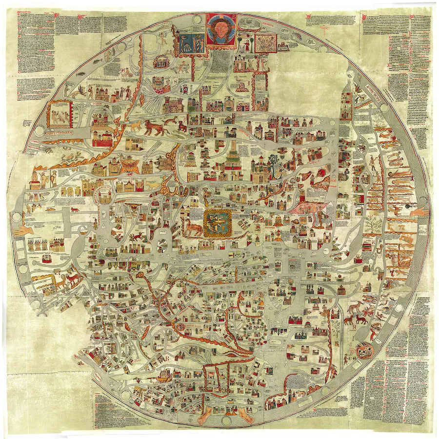
While ancient scholars had already acquired a fair knowledge of the geography of the world they knew, that knowledge was largely lost in medieval Europe. The mappae mundi appeared in Europe from the 8th century, the best-known form of which was the circular wheel types. According to the worldview of the time and due to the fact that these maps were mostly made by monks, geographical accuracy did not play the main role, but Judeo-Christian beliefs. For example, in these maps, Jerusalem is found at the center of the world. An imposing example of this mappae mundi is the Ebstorfer world map, which was probably produced around 1235 in a monastery on the Lüneburg Heath and, with a diameter of 3.57 m, is the largest known map of its kind.
World maps according to Ptolemy
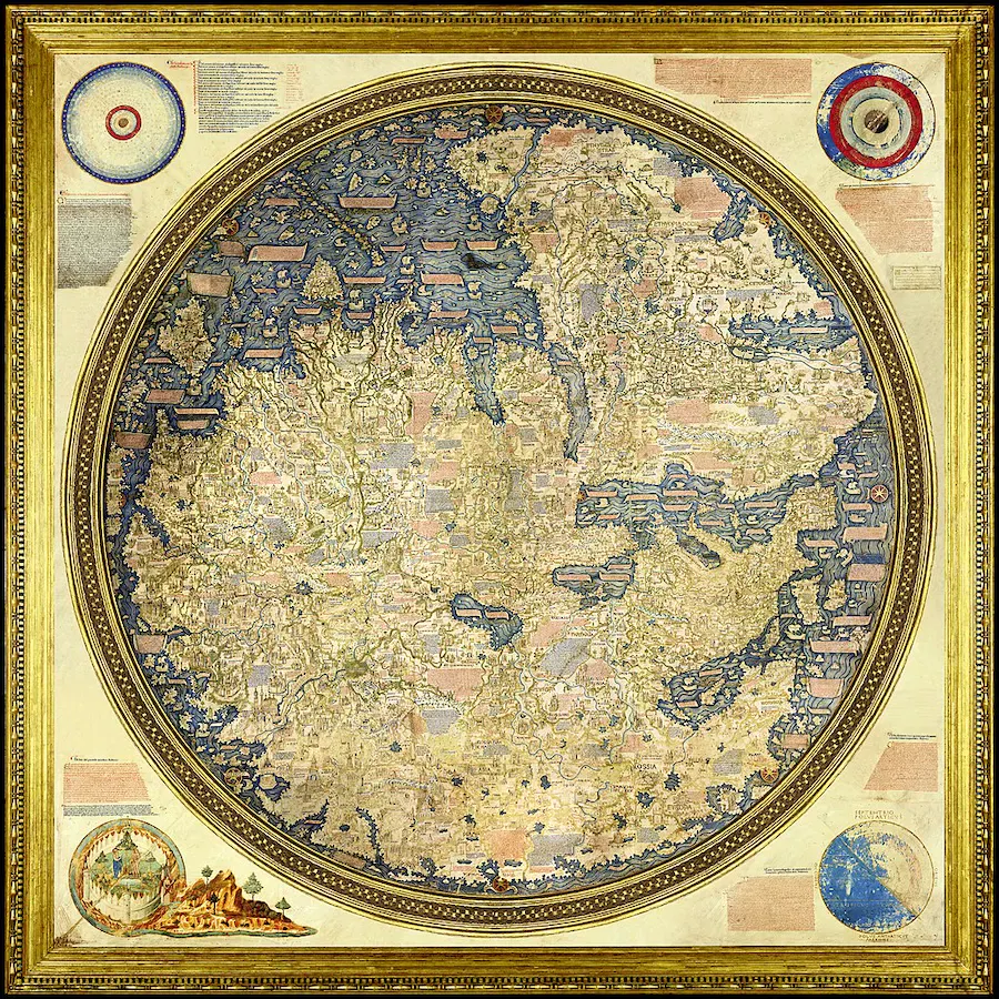
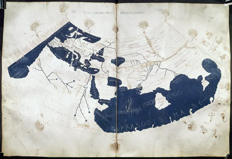
A kind of late mappa mundi is the precious and large wheel map (2.4 x 2.4 m) that the Venetian monk and cartographer Fra Mauro made in 1459 for the king of Portugal. It was not based on the Christian worldview, but on ancient geographical knowledge. This had reached Europe in the 14th century in the form of an old manuscript in Greek, an edition of the Geographical Hyphegesis, written around 150 AD by the Greek scholar Claudius Ptolemy. The manuscript itself contained no maps, but numerous geographical guides and tables, from which maps of the world known to Ptolemy were made.
Related: Mapping the World: Advice for New Collectors
Fra Mauro's Mappa mundi was also based on the information given by Ptolemy, but supplemented with the new discoveries made by the Portuguese, who were the leading naval power at the time, especially with regard to the west coast of Africa.
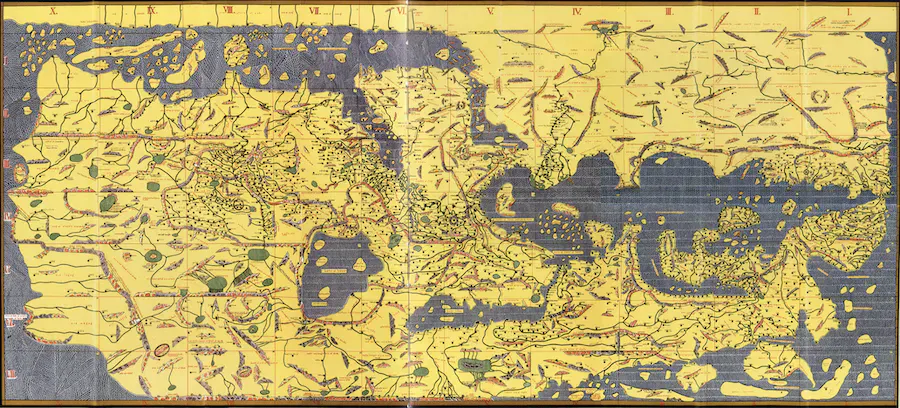
In contrast to Christian Europe, the knowledge of geography from antiquity had survived in the Islamic world in the Middle Ages, which is also reflected in their geographical works. Cartographers such as Muhammad al-Idrisi, who came from North Africa, were familiar with the work of Claudius Ptolemy. Al-Idrisi used it, for example, when he prepared the Tabula Rogeriana around 1150 for King Roger II of Sicily, at whose court he spent almost twenty years.
Tabula Peutingeriana
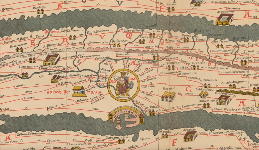
In 1507 the Augsburg humanist Konrad Peutinger received from his colleague Conrad Celtis, who lived in Vienna, a scroll map consisting of twelve segments and measuring a total of 680 cm x 34 cm, which was to be named after him: the Tabula Peutingeriana. The map, which is probably a medieval copy of a Carolingian template, shows the road network of the Roman Empire around 375. It can therefore be assumed that the Carolingian template also goes back to a Roman original from that time. The areas of the Roman Empire from the British Isles to the Near East are shown in a deliberately stylized form. However, India is also shown, which suggests that the Roman map is again based on sources from the Hellenistic period.
Do you have a globe or a map that you would like to have valued? Contact the experts at ValueMyStuff today!
Martin Behaim's Erdapfel
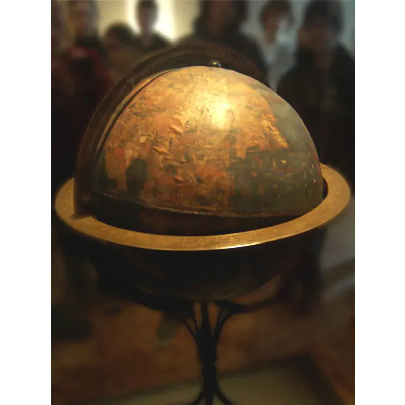
The oldest preserved terrestrial globe can be admired in the Germanic National Museum in Nuremberg. The geographical treasure with a diameter of 51 cm was made around 1492-93 under the department of the Nuremberg merchant Martin Behaim, who had been knighted there a few years earlier during a stay in Portugal, on behalf of the Nuremberg council. It is one of the last cartographic works on which the New World is missing. Christopher Columbus believed until the end of his life to have found an alternative sea route to India and shared this view with Behaim, who made his globe based on the same calculations. It is not known whether Behaim, at the time of his death in 1507, was convinced of the discovery of a new continent described by Amerigo Vespucci in his 1503 travelogue Mundus Novus.
Related: Rare Nuremberg Chronicle Sets a World Record
Waldseemüller map from 1507
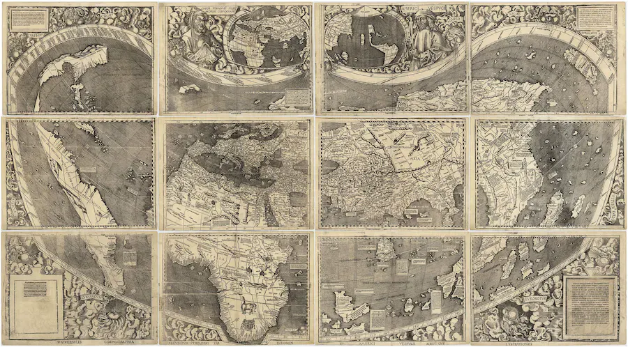
One who definitely believed in the discovery of the New World was the German cartographer Martin Waldseemüller, who, after studying mathematics and geography at the University of Fribourg, joined the humanistic circle in the monastery of Saint-Dié-des-Vosges/Sankt Didel in Lorraine. Waldseemüller dealt intensively with Amerigo Vespucci, and the world map he created in 1507 was the first to designate the previously known land mass in the west as "America". He chose this name because he believed Vespucci to be the true discoverer of the new continent, since he was the first to identify it and he also had made extensive explorations along the east coast of South America.
Related: Archaeologists Discover the World's Oldest Illustrated Book
Gerhard Merctor's maps and globes
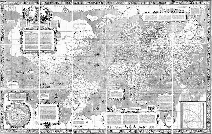
One of the most important cartographers of his time, whose influence extends to the present day, was the 16th-century Fleming Gerhard Mercator, who was hailed by his contemporaries as the "new Ptolemy". With his world map from 1569 in angular projection, he created a map that was also suitable for seafaring and was later named the Mercator projection after its inventor. The spherical surface of the earth is transferred to a two-dimensional surface as a cylinder image. The network of lines with which Mercator covered his map is still the navigation basis for all maps today, including online map services such as Google Maps.
Want more articles like this straight to your inbox? Subscribe to our free newsletter!
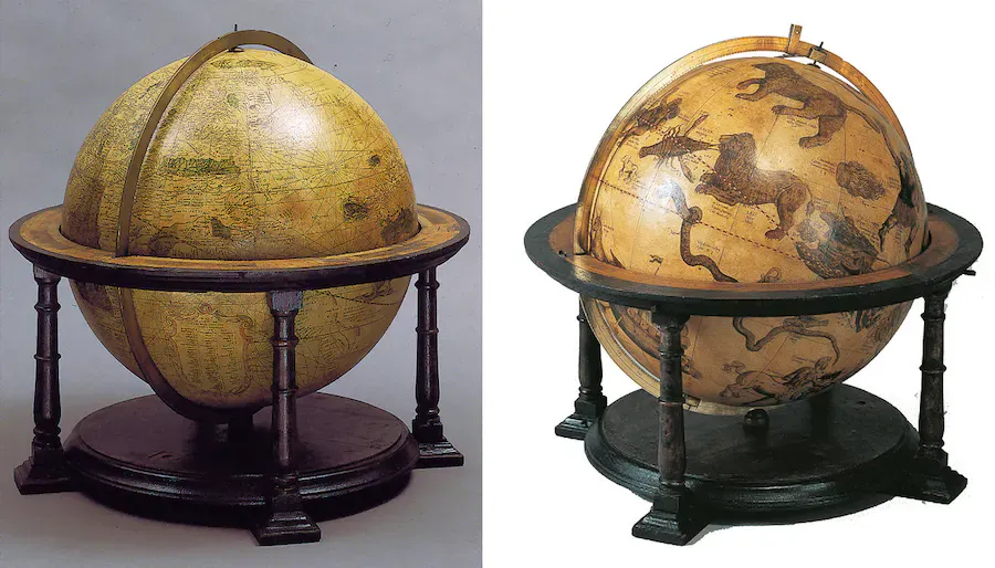
However, Mercator's 1569 world map was not the first work by the brilliant cartographer to have a lasting impact. As early as 1541 and 1551, respectively, he had created a terrestrial and a celestial globe, which inspired the trend to acquire both spheres in a double pack. This had occasionally happened before, but the fact that Mercator's works were not only state-of-the-art and were also the largest globes of their time further fueled the trend. With its representation of the rhumb lines, which always intersect longitudes with the same angle, the terrestrial globe was also a first attempt by Mercator to create a globe useful for navigation.
James Cook's map of the southern hemisphere
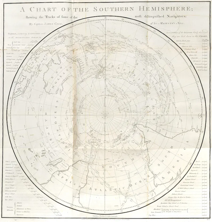
James Cook's Southern Hemisphere Map is not a map of the world, but it provided many new insights and dispelled a myth that had troubled humanity for centuries: the existence of a vast southern continent that was supposed to counterbalance the land masses of the northern hemisphere. After being the first European to set foot in Australia on his voyage to the South Seas (1768-71), Cook set out on his second voyage (1772-75) in search of the fabled continent, probably becoming the first person to cross the Arctic Circle. He couldn't make it to actually existing Antarctica, but his map of the southern hemisphere made it clear that there was not enough space for a huge land mass.