




Bring your auction to collectors worldwide!
Get listed nowBy subscribing, you are agreeing to the privacy policy. Unsubscribe anytime.
Barnebys HQ
Brahegatan 10
BOX 5038
114 37 Stockholm
All auctions / Arts & Graphics / William Holmes "The Grand Canon at the foot of the Toroweap - Looking

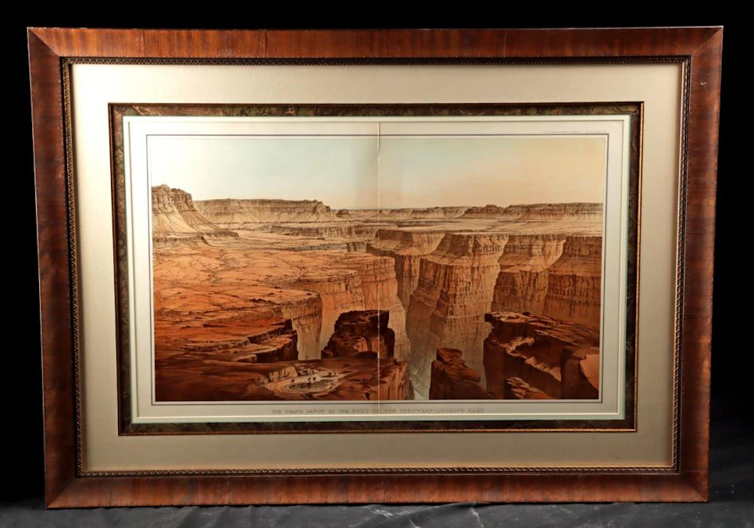
William H. Holmes (American, 1846-1933). "The Grand Canon at the foot of the Toroweap - Looking East," chromolithograph, , printed by Julius Bien and Co., New York, 1882. Published in: Clarence E. Dutton, "Tertiary History of the Grand Canon District, with Atlas." United States Geological Survey Monograph II. Washington, D.C.: Government Printing Office, 1882. A chromolithograph of vertiginous authority, produced at the precise moment when American science and American landscape art discovered they had the same ambition. The view opens from the foot of the Toroweap formation looking east across the Grand Canyon of the Colorado. The canyon's throat drops away in the foreground while tier upon tier of mesa and plateau recedes to a pale Arizona horizon. In the canyon bottom, barely perceptible against the scale of the abyss, a pool and a cluster of figures assert human presence with deliberate humility. Size of print: 32" W x 19" H (81.3 cm W x 48.3 cm H); of frame: 43" W x 30.5" H (109.2 cm W x 77.5 cm H) Holmes renders the canyon not as spectacle alone but as argument. Every stratum of Kaibab limestone, Coconino sandstone, and Vishnu schist is legible, each horizontal band a chapter in a geological chronicle spanning hundreds of millions of years. The palette moves from deep burnt sienna and Venetian red in the foreground cliffs through warm ochre on the middle terraces to the pale buff and grey of distant escarpments dissolving into sky. This tonal sequence was achieved through the layered printing process that Julius Bien and Co. had brought to its American zenith. Holmes was simultaneously a geologist, an artist, and a topographic draftsman of exceptional precision. Nowhere is that triple competence more evident than in this plate, which served both as scientific record and as one of the most powerful images of the American West produced in the 19th century. Holmes had accompanied Clarence E. Dutton on survey expeditions across the Colorado Plateau beginning in the mid-1870s, developing the intimate knowledge of the canyon's geology that gives his illustrations their unusual authority. His draftsmanship was not merely decorative. It was analytical, trained to translate three-dimensional geological structure into two-dimensional form with a fidelity that photographs of the era could not yet achieve. The publication from which this plate originates is among the most distinguished scientific volumes produced in 19th-century America. "Tertiary History of the Grand Canon District, with Atlas" was the inaugural monograph of the United States Geological Survey, an agency established by act of Congress in 1879 to systematically map and document the public lands of the American West. Dutton, a geologist and U.S. Army officer who had joined explorer John Wesley Powell's Colorado Plateau surveys in 1875, authored the text. The monograph appeared in 1882 as the first in the Survey's prestigious Monograph series, setting a standard of scientific and visual ambition that subsequent volumes would struggle to match. The accompanying atlas, printed by Julius Bien and Co. of New York, one of the foremost lithographic firms in the United States at the time, contains twenty-two maps and panoramic plates. The atlas is bound in dark brown cloth stamped in gilt, a physical object as deliberate and formal as the science it contains. Contributions by Thomas Moran, already celebrated for his monumental Grand Canyon canvases, appear alongside Holmes's plates, making the atlas a collaboration between two of the most important visual interpreters of the American West. Dutton famously declared the Grand Canyon "by far the most sublime of all earthly spectacles," and Holmes gave that declaration its definitive visual form. The publication played a direct role in shaping public and governmental understanding of the canyon, contributing to the broader 19th-century movement that would eventually lead to its federal protection. This plate, with its panoramic sweep and geological precision, is among the most reproduced and recognized images to emerge from that foundational survey. Item # 202001
Estimate:$1,400
To the auctionView all items fromArtemis Fine ArtsorArts & Graphics
Estimate:
$1,400
Unknown painter, 17th century: The Prophet Balaam and the Angel in
09/28/2026

$698.32
Est: $926.98


Bring your auction to collectors worldwide!
Get listed now
August Fischer: Landscape from Northern Italy. Signed and dated Aug.
09/28/2026
$910.86
Est: $1,235.98
Thorald Læssøe, Lorenz Frølich: "View on the Road to the Monastery
09/28/2026
$3,643.44
Est: $3,089.96
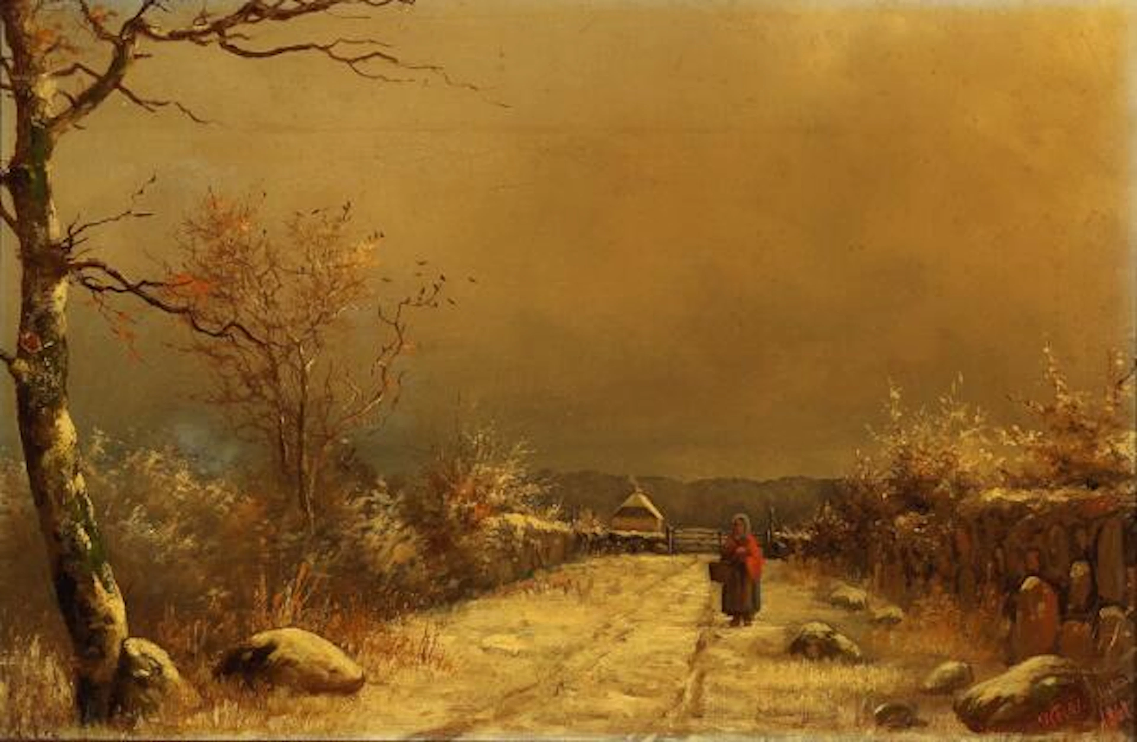
Hans Friis: A woman walking in a winter landscape. Signed and dated.
09/28/2026
$1,669.91
Est: $609.49