






OCT 23 | 8:00 AM

All auctions / Books, Maps & Manuscripts / Lithuania - Grand Duchy of Lithuania: Belarus

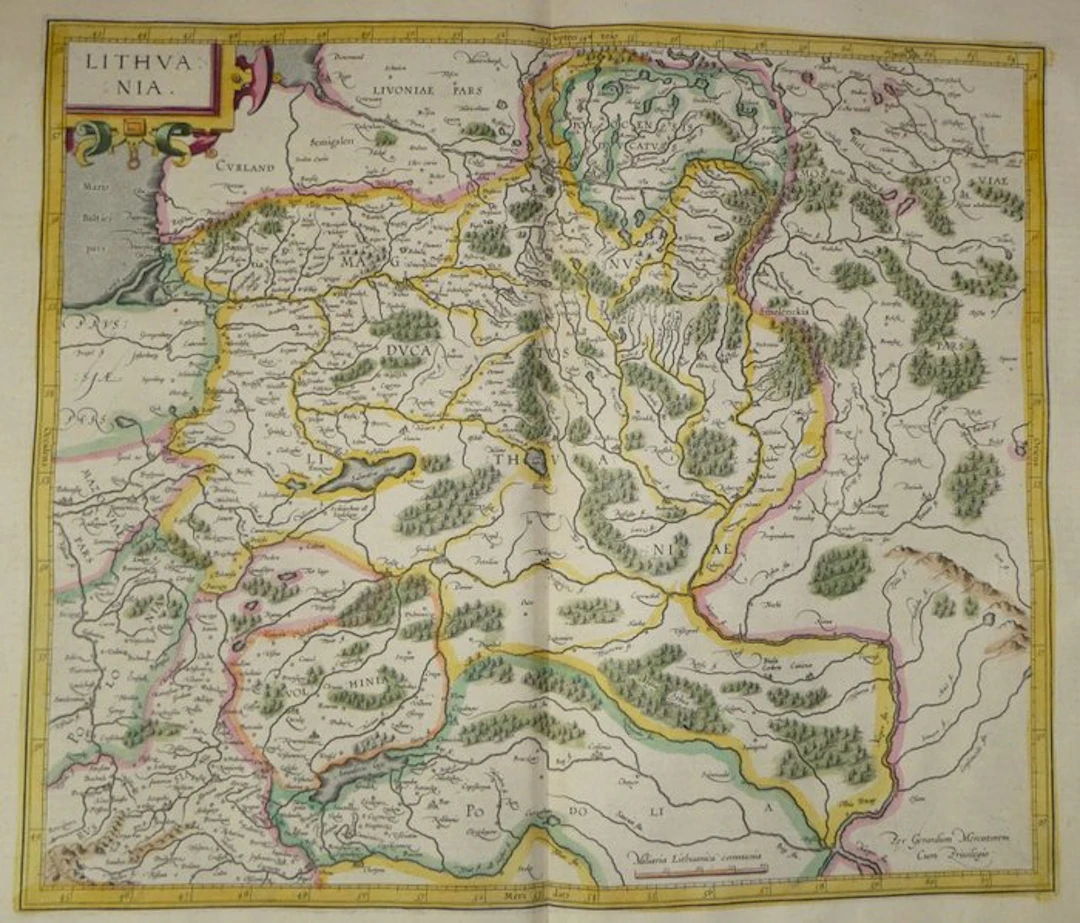
Old copper-engraved map of Lithuania, hand-tinted, by Mercator, published in 1633 in the Mercator-Hondius atlas. It shows the Grand Duchy of Lithuania and its neighboring provinces, from Courland and Livonia to the north to Podolia and Kiev to the south. The title “Lithvania” is inscribed in a cartouche with scrollwork and spikes, in the upper left. The frame is graduated in latitude and longitude. Main cities, such as Wilna, Riga, Memel, Grodno, Vitebsk and Kiof, are indicated by vignettes. The hydrographic network is detailed: Neper (Niester), Memel, Duna, Bug and Niester, as well as the lakes Salmatia, Amadoca and Crono. Forests and reliefs are drawn with perspective. The scale is given in “Miliaria Lithuanica communia.” The period coloring emphasizes the boundaries of the provinces and the palatinates. The inscription “Per Gerardum Mercatorem Cum Priuilegio” appears at the bottom right. The verso bears the French text of pages 185 and 188 (“Duché de Lithuanie, Samogitie, Russie & Volhinie”). - Dimensions: on the sheet: 56 x 47.5 cm; on the plate (map): 46.9 x 35.3 cm - Condition: Good overall for a map of this period. Presence of a central vertical fold and light stains. See photos for more details. Atlas Mercator-Hondius - The atlas called “Mercator-Hondius” reuses the work of Gerard Mercator, whose copperplates were bought back by Jodocus Hondius in 1604. This French edition of 1633 is signed by his son Henricus Hondius and his son-in-law Joannes Janssonius, who augmented it with new maps. Gerard Mercator – Gerard Mercator (Rupelmonde, 1512 – Duisburg, 1594) was a Flemish cartographer, geographer and engraver. Trained at Leuven, he produced a terrestrial globe there in 1541, then settled in Duisburg. In 1569, he developed the projection that bears his name. His Atlas was published posthumously in 1595 by his son Rumold. Jodocus Hondius bought the plates in 1604 and continued the edition in Amsterdam, with Henricus Hondius, who signs the address of 1627 appearing on this map.
Estimate:$246.5
To the auctionView all items fromCatawikiorBooks, Maps & Manuscripts
Estimate:
$246.5
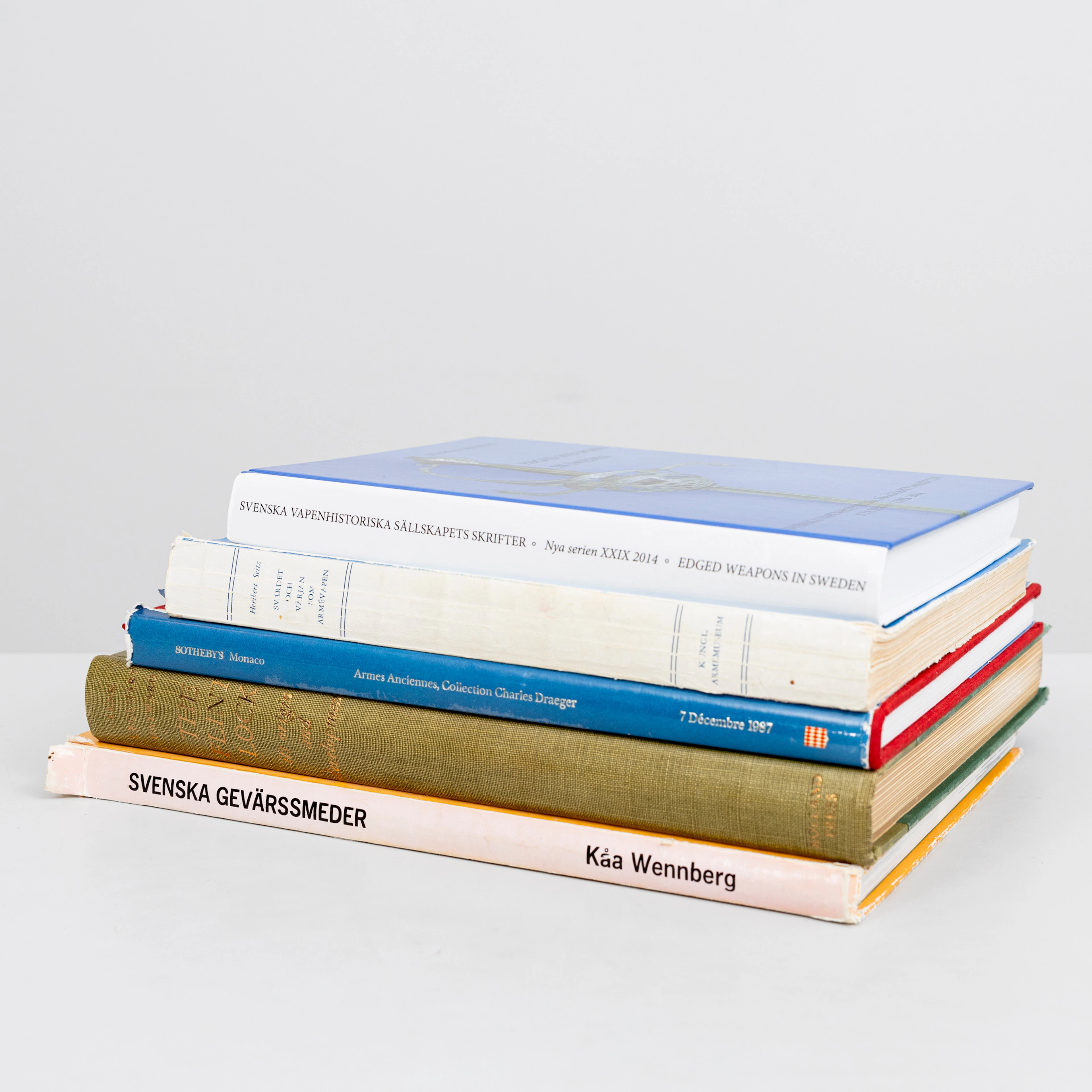
LITTERATUR, tema Militaria, 5 delar, bl.a "Svärdet och värjan som
10/11/2026
$74.71
Est: $120
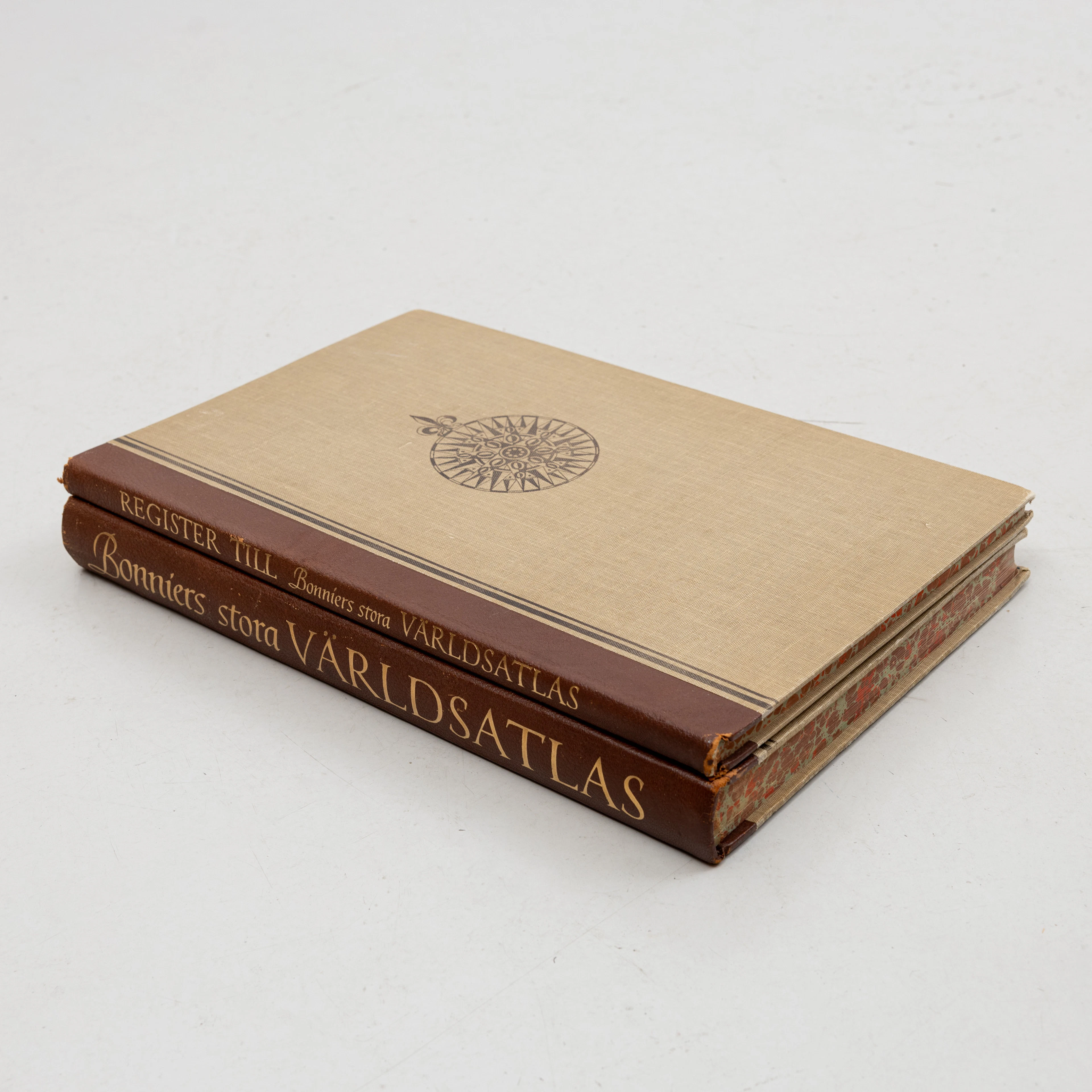
KARTBOK samt REGISTER,, FÖRSTORINGSGLAS, Bonniers Stora Världsatlas
10/11/2026
$69.73
Est: $119.52
OCT 23 | 8:00 AM


OCT 17 | 10:00 PM


Bring your auction to collectors worldwide!
Get listed nowBy subscribing, you are agreeing to the privacy policy. Unsubscribe anytime.
Barnebys HQ
Brahegatan 10
BOX 5038
114 37 Stockholm
