![[MANUSCRIT] [SUISSE] [ALPINISME] Rose ô Espine ou la vraye chrosnicque](https://bbys.imgix.net/1663/1a68efe1cf553661cd18f1c8b81dc48d917032e57cc6a889e01382ed73732bf8.jpg?auto=format&w=3840&q=75)


![[LE TOURNEUX (Nicolas)]. The Roman Breviary, in Latin and Fr - Lot 61](https://bbys.imgix.net/337/25357994da5929e1538689f7f0f719d7f9d68d41a42bcfb70f89397f8257f5b2.webp?auto=format&w=3840&q=75)



OCT 27 | 4:00 PM

All auctions / Books, Maps & Manuscripts / Asia - Thailand

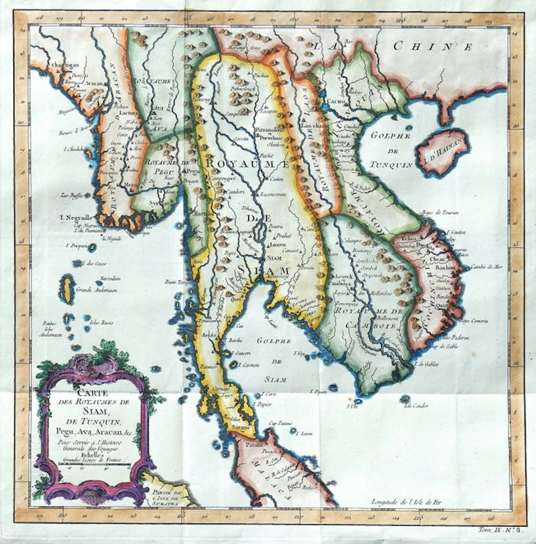
Technical sheet Title: Carte des Royaumes de Siam, de Tunquin, Pegu, Ava, Aracan, &c. Pour servir à l’Histoire Générale des Voyages. Author: Jacques-Nicolas Bellin (1703–1772). Author of the originating work: Antoine-François Prévost (1697–1763). Publisher: Didot. Place: Paris, France. Era: 1751. Technique: copper engraving on steel plate, with aquatint and burin, with manually applied period coloring not verified. Support: laid paper. Dimensions: imprint 28 × 28 cm; sheet 31 × 34 cm. Inscriptions: title within cartouche at lower left; reference “Tom. IX. N° 8” at lower right; indication “Longitude de l’Isle de Fer”. Composition: single folded plate, taken from volume IX of the Histoire générale des voyages, ou nouvelle collection de toutes les relations de voyages par mer et par terre. verso: white. Description Map of mainland Southeast Asia drawn by Jacques-Nicolas Bellin for the Histoire générale des voyages by Antoine-François Prévost, published in Paris by Didot in 1751. The representation includes the kingdoms of Siam, Tonkin, Pegu, Ava and Arakan, together with Laos, Cambodia and Cochinchina, outlining a territory corresponding mainly to today’s Thailand, Myanmar, Vietnam, Laos and Cambodia. The map also extends to the Malay Peninsula, part of southern China, the island of Hainan and the Andaman archipelago, including a portion of Sumatra in the lower left corner. The river network plays a central role in the geographic construction: waterways, settlements and mountain ranges describe the organization of the territory, while coves, bays, promontories and islands line the coasts. The names of the kingdoms reflect the political and geographic framework adopted by European cartography in the mid-18th century. Manual coloring distinguishes the main territorial divisions and emphasizes the coastal profile with blue shading. In the lower left a ornamental cartouche with scrolls and vegetal motifs encloses the title and the scale in large French leagues. The graduated frame completes the cartographic apparatus, with longitudes referred to the meridian of the Ferro Island. Historical-artistic note Jacques-Nicolas Bellin was a central figure of French cartography in the 18th century, active in hydrography and the production of maps for navigation and geographic study. His contribution to the Histoire générale des voyages complemented Prévost’s gathered accounts with a broad cartographic apparatus, meant to render intelligible itineraries, territories and relations between the different regions of the world. This map of the Southeast Asian kingdoms unites such didactic function with the precision of the engraved drawing and the ornamental taste of 18th-century geographic publishing. Condition Report Copy in generally good condition. Vertical and horizontal editorial folds, with slight waviness of the paper. Small tear on the left margin, minor edge wear and sporadic small stains, more evident on the verso. The cropping in the lower right margin is due to the original layout of the plate within the volume and binding requirements; it does not constitute accidental damage and does not affect the map area. Sharp impression and well-preserved coloring. Verso white, with slight color bleed-through.
Estimate:$167.94
To the auctionView all items fromCatawikiorBooks, Maps & Manuscripts
Estimate:
$167.94

QUIGNARD (Marie-Françoise) & SECKEL (Raymond-Josué), dir. — - Lot 241
10/11/2026

$156.23
Est: $22.4
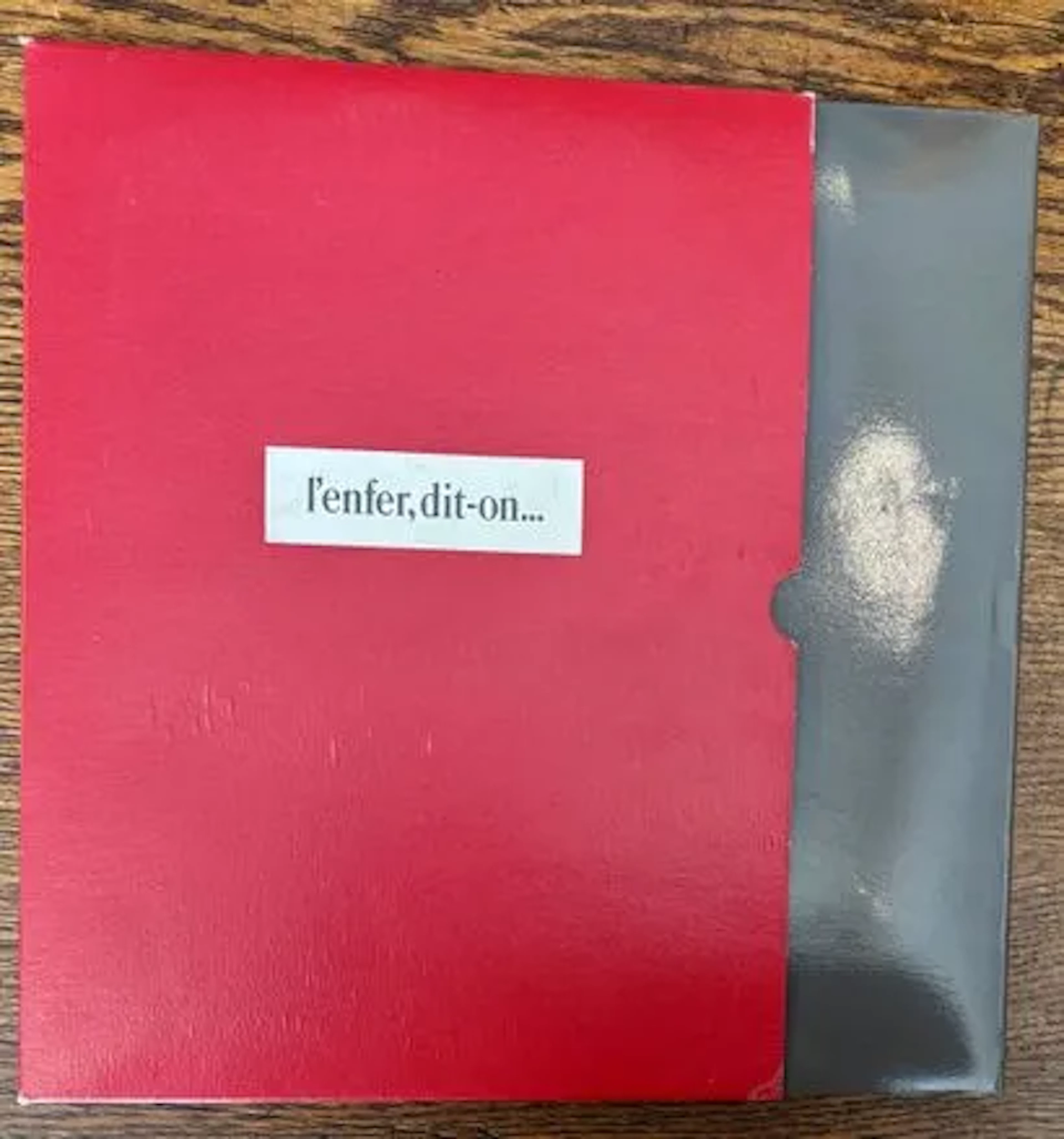
NOËL (Bernard). — L'Enfer, dit-on… Dessins secrets 1919-1939 - Lot 209
10/11/2026
$26.78
Est: $67.22

OCT 27 | 4:00 PM


OCT 23 | 8:00 AM


OCT 17 | 10:00 PM
Bring your auction to collectors worldwide!
Get listed nowBy subscribing, you are agreeing to the privacy policy. Unsubscribe anytime.
Barnebys HQ
Brahegatan 10
BOX 5038
114 37 Stockholm
