





All auctions / Books, Maps & Manuscripts / Antique Map of Ireland, French, Framed Cartography, Eire, Georgian, Circa 1780
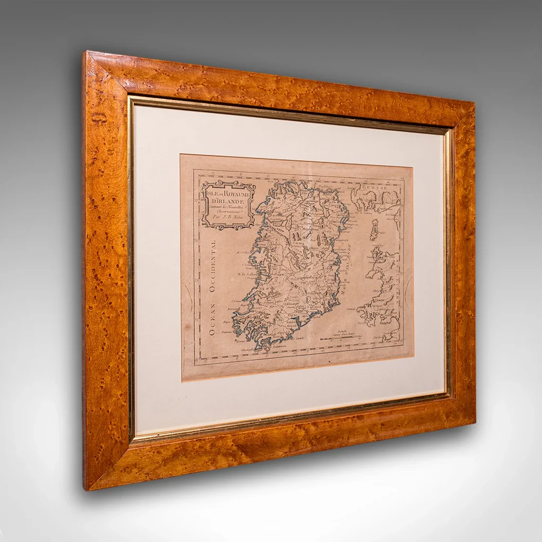
This is an antique map of Ireland. A French, maple framed cartography engraving by Jean-Baptiste Nolin, this posthumous atlas edition dating to the Georgian period, circa 1780. Full Title: This is a fascinating late 18th century Ireland map, a delightful atlas engraving published by the cartographer's son. Perfect for collectors of antique maps and national history. Delivered ready to display. Max Width: 47.5cm (18.75'')Max Depth: 2cm (.75'')Max Height: 42.5cm (16.75'') Map Width: 28.5cm (11.25'')Map Height: 23.5cm (9.25'')
Estimate:$1,187.7
To the auctionView all items fromLondon Fine AntiquesorBooks, Maps & Manuscripts
Estimate:
$1,187.7
![[ARTIFICIALIA] - Lot 55](https://bbys.imgix.net/3903/3bd85f7da67b50bc09f82d11a040b298cab332601999958b7d63f80889d369ad.webp?auto=format&w=3840&q=75)
![Berry (William), [Composite Atlas], London: Sold by William ...](https://bbys.imgix.net/3845/8fb8fd9d260ffc5f3ff4d54ce81154a5f8e4535b41053190a59cb23a74ea6d22.jpg?auto=format&w=3840&q=75)




OCT 17 | 10:00 PM
Bring your auction to collectors worldwide!
Get listed nowBy subscribing, you are agreeing to the privacy policy. Unsubscribe anytime.
Barnebys HQ
Brahegatan 10
BOX 5038
114 37 Stockholm
